In Vietnam, you can walk through highland valleys, dense forests, terraced rice fields, and limestone caves. Here are the 10 best trekking trails. Vietnam’s beautiful nature offers rewarding opportunities for trekking – even around Saigon, known for its vibrant city life, delicious food, and rich history. Starting from the south of Saigon and moving up to the North of the country, we have compiled a list of 10 trekking trips to experience.
Dinh Mountain
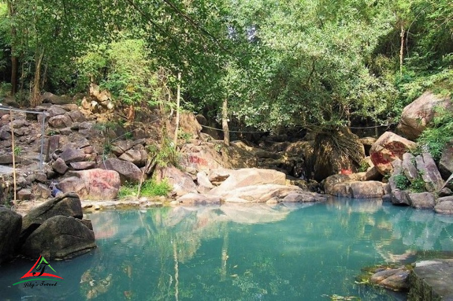
A 90-minute walk from Saigon, Dinh Mountain is the perfect relaxing getaway for your week. It is nestled in the treetops and streams of mountains, Buddhist temples and pagodas and immersed in panoramic views at the top of the mountain. The path does not have many signposts, but there are red, yellow, and blue markings to help you, so go hiking with someone you know.
Approximate Distance: 12.8 km
Estimated Completion Time: 4.5 hours
Difficulty Rate: 2/5
Chua Chan Mountain
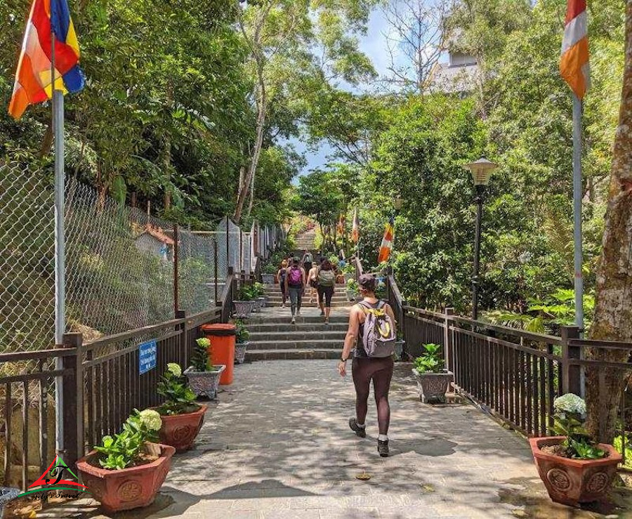
You are climbing the 800-meter-high Chua Chan Mountain in Dong Nai province, a two-hour drive from Ho Chi Minh City. The first part of the climb is a scorching stone paved stairway; at the top, relax in the shade of the mountain pagoda and treat yourself to some fried bananas or pancakes (pancakes). As you pass the pagoda, follow the dirt path to the top. The mountain has stunning scenery, spectacular caves and the famous banyan tree. The trekking trail is easy to follow and you can even camp on the mountain overnight. There is also a cable car that runs from the pagoda to the bottom of the hill.
Approximate Distance: 7.5 km
Estimated Completion Time: 3 Hours
Difficulty Rate: 2/5
Read more: Cu Chi tunnels tour: 3 options for you to choose
Ba Den Mountain
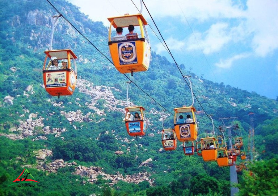
Located in Tay Ninh province, 2 hours by motorbike from Saigon, this 996 m high mountain is the highest peak in South Vietnam. When you enter Black Virgin Mountain Park, you may either walk for an hour or take a 4-minute cable car trip to the pagoda. After arriving at the pagoda, you climb the stairs 45 minutes before the walk begins. There are also overnight camping options for a whole weekend getaway.
Approximate Distance: 8 km
Estimated Completion Time: 6 Hours
Difficulty Rate: 3/5
Lang Biang Mountain
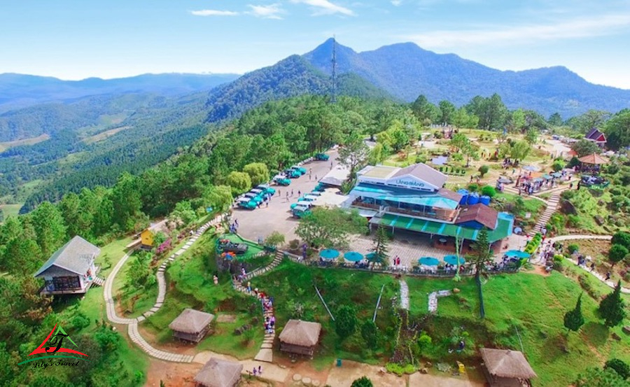
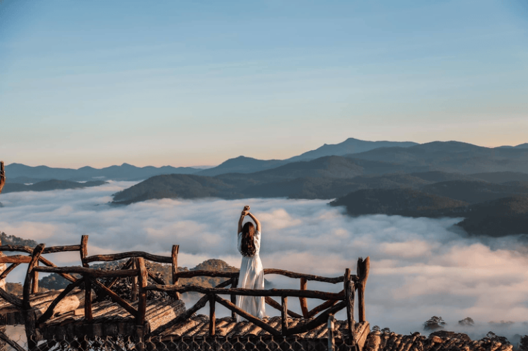
After visiting Saigon’s three most famous mountains, catch a bus and head to the cool highlands – Da Lat. From Saigon, you should choose to explore the area’s pine and moss forests as you make your way up Lang Biang Mountain. At the top of the mountain, you can camp overnight or complete a day hike. You may also take the opportunity to trek through the canyon.
Approximate Distance: 9.5 km
Estimated Completion Time: 4 Hours
Difficulty Rate: 2.5/5
Read more: Experience booking a Halong cruise for foreigners
Ta Cu Mountain, Mui Ne
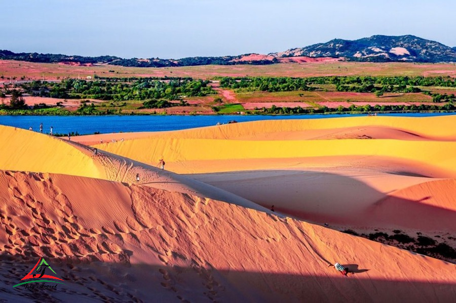
Ta Cu Mountain trekking takes you through lush rainforest, limestone caverns, and uncommon animal species. Ta Cu Mountain has two uniquely pagodas: Ha Pagoda and Thuong Pagoda. A White Buddha statue is 11 m high and 45 m long lying on the side of the mountain. Make the hike a weekend adventure with a trip to nearby Mui Ne, a coastal desert in Vietnam famous for its flaming white-red dunes. Mui Ne offers many local delights: stroll around fishing piers, traditional craft villages, and ancient architectural works, and remember to try their fresh seafood dishes. Soak your ankles in the unique fairy stream and camp on the beach to catch the sunset on the dunes in vivid colors.
Approximate Distance: 2.3 km
Estimated Completion Time: 2 Hours
Difficulty Rate: 2.5/5
Cat Tien National Park
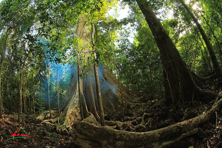
Cat Tien National Park, located in Dong Nai province, is Vietnam’s closest and largest National Park near Saigon. Walk through the park’s forest to see the giant Tung and Bo Dong redwoods and wildlife such as gibbons, sambar deer, wild boars, black-legged douc langurs, elephants, and even tigers. Tour guides are optional as long as you follow the walking paths of the park, which are flat. You can relax in hammocks inside the park, surrounded by jungles and rivers. You can also sign up for a three-day walk back to the apes to see these endangered primates in the wild. You must book a tour because Cat Tien limits the number of guests daily.
Approximate Distance: 8.5 km
Estimated Completion Time: 2 Hours
Difficulty Rate: 1/5
En Cave (Phong Nha Ke Bang National Park)
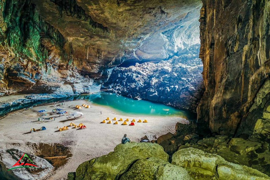
UNESCO recognizes Phong Nha-Ke Bang National Park as a World Heritage Site, home to a particular cave system with the largest cave in the world: Son Doon. Along the way, you can visit Hang En, the world’s third-largest cave. It is safest to register with a travel agency to explore these caves. For example, the Hang En Expedition Camp hike is a 25-kilometer hike through jungles and rivers (in the forested area of the National Park), with an additional 4 kilometers of rock walking through many caves. You camp overnight in Hang En, a once-in-a-lifetime spectacular experience.
Approximate distance: 29 km
Estimated completion time: 2 days
Difficulty assessment: 5/5
Sapa
A top destination area for hikers, the country’s northwestern Sapa region is central to Vietnamese tribal culture. Four main ethnic groups – the Hmong, Red Dao, Tay and Giay ethnic groups – live in villages. Sapa has a dense trail network that intertwines in countless ways, taking you through rugged wilderness and beautiful rice paddies. Guidance on trekking is needed to help navigate the area. You may hire a guide to take you to the villages from Sapa town. The trail from Lao Chai of Muong Hoa Valley to Ta Van Valley is very suitable for beginners, as many sections have been paved, but some muddy and slippery areas are still paved. Cat Cat Village to Y Linh Ho, Sa Sen to Hou Tao, and Ma Tra to Ta Phin Village are all popular treks. You may stay with a local family and learn about local food and cultural practices.
Approximate Distance: 3 km
Estimated Completion Time: 1 hour
Difficulty Rate: 1/5
Phanxipang Peak, Sa Pa
Located at an altitude of 3,143 m in Hoang Lien National Park, Phanxipang is the highest peak in Vietnam, Laos and Cambodia, known as the “Roof of Indochina”. End your Sapa trip by conquering one of the country’s most challenging trekking trails, with blooming trees, streams, and wildflowers to accompany you. The trail requires extending some large rocks and stairs, so remember to train your strength for this physical challenge.
Approximate Distance: 11.2 km
Estimated Completion Time: 6.5 hours
Difficulty Rate: 4/5
Cao Bang
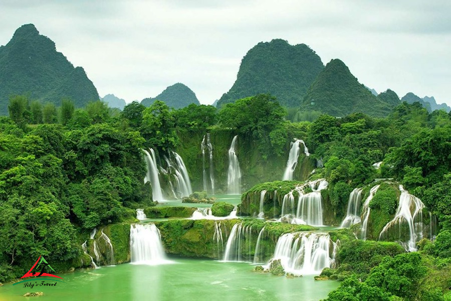
To the east of Sapa is Cao Bang. The area is attracting the attention of adventurous hikers for its pristine quality and unspoiled natural beauty. Still, this perceived pristineness results from deep historical significance: located right on the border with China, Cao Bang has been a disputed area between the two countries for many periods of war. Later, it served as a base for North Vietnamese rebels, earning it the moniker “Cradle of the Revolutionary Movement”. Ho Chi Minh had a period of hiding in a cave in Pac Bo. Trekking through the area also allows you to see the iconic Ban Gioc Falls, one of the most majestic waterfalls in Southeast Asia. Ba Be National Park and its caves, lakes and ponds can also be glimpsed. The distance and time required to accomplish the journey are determined by your tour.
Approximate Distance: 20 km
Estimated Completion Time: 4 Days
Difficulty Rate: 3.5/5
The best center Vietnam tour: Tour in Vietnam


