The “Ha Giang loop” is a term familiar to international tourists referring to the scenic route exploring Ha Giang. So what exactly is the Ha Giang loop? How long is the Ha Giang loop? Lily’s Travel Agency will explain it to you right here!
What is the Ha Giang loop?

The “Ha Giang loop” is a term well-known to adventure seekers who enjoy motorcycle tours, especially those keen on exploring the majestic beauty of Vietnam’s mountains. The Ha Giang loop is not just a route, but also a challenging and experiential journey, described by many as one of the most memorable in Southeast Asia.
How long is the Ha Giang loop? The Ha Giang loop is a 350km route that starts and ends in Quản Bạ, passing through Yên Minh, Đồng Văn, and Mèo Vạc. This route is famously known for its winding roads, steep mountains, and high passes that stretch across gorges and cliffs, creating spectacular and striking landscapes. The Ha Giang loop traverses incredible geological features, from fault lines to rock fields with strange formations, through stunning natural scenery unmatched anywhere else in the world.
Key Features of the Ha Giang loop
One of the most prominent features of this route is the Mã Pí Lèng Pass, one of the top four passes in Vietnam. The Mã Pí Lèng Pass presents a challenge to drivers with its altitude and treacherous roads. The area around this pass is also home to 22 ethnic minorities, each with unique cultural identities and cuisines, enriching the journey even further.
Challenges of the Journey
The Ha Giang loop is not for the faint-hearted. It requires courage and good driving skills, especially when navigating high passes, deep gorges, and often foggy weather. The harsh climate, with winter sometimes bringing frost, also adds to the difficulty of the journey.
For those who love adventure, discovery, and challenges, the Ha Giang loop is a journey not to be missed. Its allure lies not only in its natural beauty but also in the deep connection between people and nature.
How long is the Ha Giang loop?

How long is the Ha Giang loop? The Ha Giang loop, one of the most adventurous and appealing routes in Vietnam, is about 350 km long. This journey attracts motorcycle enthusiasts due to its challenging and winding terrain. To conquer this road, participants need good driving skills and experience in navigating steep mountain passes.
The average time to explore the entire route usually ranges from 4 to 5 days. However, if you want to fully enjoy each moment and delve deeper into the beauty of the various stops along the way, the time can extend up to 7 days. Certainly, this will be an ideal challenge for those who want to explore the pristine beauty and test themselves on treacherous roads.
Read more: How to Travel from Sapa to Ha Giang?
What to pack for motorbiking the Ha Giang loop?
When planning a motorcycle trip around the Ha Giang loop, one of the most beautiful routes in Vietnam, international travelers need to prepare thoroughly to ensure safety. First, you should carry a valid passport or travel visa. Don’t forget an international driving license if you plan to ride the motorcycle yourself.
A lightweight backpack will be very convenient for carrying all necessary items. Also, do not forget a raincoat as the weather in Ha Giang can be unpredictable. Comfortable sneakers are the best choice for easy walking on mountainous roads.
For personal items, bring necessary personal hygiene items and a portable charger to ensure your phone is always charged, helping you take pictures or use GPS when needed. Cash is indispensable, as many places in Ha Giang do not support card payments.
Finally, a small first aid kit is always necessary to handle emergencies, and clothing suitable for the fluctuating mountain weather. This thorough preparation will not only ensure your safety but also make your trip more convenient.
Itinerary for the Ha Giang Loop
Day 1: Ha Giang – Khuoi My – KM0 Milestone – Quan Ba – Nam Dam
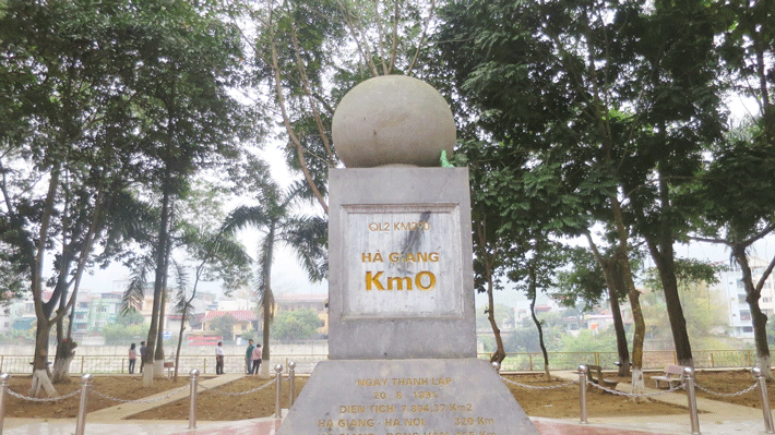
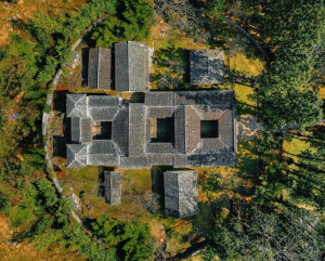
The first day of the four-day, five-night Ha Giang motorbike trip begins with a visit to Khuoi My village, located 12km from Ha Giang city center. This village is renowned for its pristine beauty, terraced fields, and moss-covered ancient roofs. Khuoi My actually comprises three villages and can only be experienced under the guidance of the local people.
The road to this village is steep and narrow, requiring careful driving. Situated at an altitude of 1000 – 1200 meters above sea level, Khuoi My enjoys a fresh and cool climate, often enveloped in fog. The residents are mainly of the Tay and Dao ethnic groups, famous for their “tra shan tuyet co thu”. The journey then continues to the KM0 milestone in the city center, marking the start of the loop. The final leg of the day takes you to Quan Ba, where you can view the panoramic scenery of Tam Son town and the Twin Mountains. At night, you will stop at Nam Dam cultural tourism village to relax with the traditional Red Dao herbal bath.
Day 2: Ha Giang – Yen Minh – Tham Ma slope – Pao’s House – Vuong Family Mansion – Dong Van Old Quarter
On the second day, travelers will explore from Yen Minh to the Tham Ma slope, continue through Pao’s House and the Vuong Family Mansion, and end at Dong Van Old Quarter. Starting from Yen Minh, the winding QL4C road offers spectacular views of the Yen Minh pine forests, an ideal spot for photography. Next is the Tham Ma slope, a challenging stretch of road with beautiful curves that require skilled motorcycle handling.
Day 3: Ha Giang – Lung Cu flagpole – Ma Pi Leng Pass – Nho Que River – Meo Vac
On the third day, the journey continues from Lung Cu to Meo Vac via the Ma Pi Leng Pass. Lung Cu, the northernmost point of Vietnam, is an essential stop on the Dong Van Plateau trip. After traveling 26km along the mountain pass and climbing 389 steps, you reach the top of Lung Cu, from which you can see most of the Vietnamese territory and the majestic beauty of the Dong Van stone plateau. In September, the scenery becomes even more spectacular with golden ripe terraced rice fields.
Day 4: The Journey from Meo Vac to Ha Giang City
On the return journey from Meo Vac, travelers will pass through Ha Giang City, winding along the mountain pass through Lung Phin, Mau Due, Duong Thuong, and Lung Tam to Quan Ba, before reaching Ha Giang City. Along the way, travelers will experience steep, twisting roads shaped like the letter M. Notably, Lung Tam and the Cong troi Quan Ba are ideal spots for enjoying peaceful sunsets and relaxation. The exploration journey in Ha Giang officially ends with many memorable experiences.
Which season is best for motorbiking in Ha Giang?
Ha Giang, a land of majestic limestone highlands, dons a distinct beauty each season. However, if one must choose the best season to explore Ha Giang by motorbike, spring would certainly be the ideal time.
Ha Giang in Spring

Spring in Ha Giang starts with the cheerful atmosphere of traditional festivals, where locals and visitors engage in folk games. Particularly, in March, the blossoms of peach and plum trees begin to flourish, adding a poetic touch to the mountainous landscapes of Ha Giang. The roads in Sung La and Lao Xa in Dong Van at this time are as beautiful as paintings, making them unmissable destinations for those who love natural scenery and want to capture beautiful moments of the blooming season. The climate in spring is quite cool and clean, with mild sunlight, providing ideal conditions for travelers to fully explore the roads by motorbike without worrying about the heat. Experiencing the drive through winding mountain roads, breathing in the fresh air, and admiring the spectacular landscapes of Ha Giang in spring, you will find there is no better season to explore the pristine and majestic beauty of this place.
Ha Giang in Summer
Summer in Ha Giang begins with the prominent Khau Vai Love Market festival, occurring at the end of March and the beginning of April. This is not only a place for local people to meet and chat but also a destination for visitors interested in local culture. The market gathers annually on the 27th day of the third lunar month, attracting a large crowd with a lively, bustling atmosphere. At this time, the weather in Ha Giang is quite pleasant, with little rain and plenty of sunshine, making it an ideal time to explore and take stunning photos.
Ha Giang in Autumn

As the weather cools down in autumn, Ha Giang dresses in the golden hues of ripe rice on terraced fields. This is the ideal time to admire the peaceful, simple beauty of the landscape here. Hoang Su Phi, home to some of the most beautiful terraced fields in Vietnam, becomes a must-visit destination for anyone who loves nature and seeks a quiet, relaxing space during this season.
Ha Giang in Winter
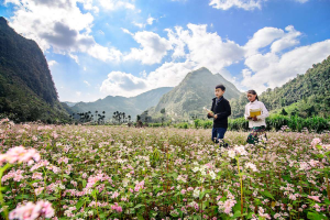
Winter in Ha Giang offers a different beauty, as the weather turns cold, but the scenery becomes extremely attractive with the purple of buckwheat flowers covering the hills in October and November. By December, bright yellow mustard flowers begin to bloom, creating a splendid scene, especially impressive amid the cold of winter.
Each season in Ha Giang has its own unique characteristics, offering memorable experiences to visitors. No matter the season, Ha Giang remains an ideal destination for those passionate about exploration and who love nature.
Read more: Guide to 4 ways to travel from Hanoi to Ha Giang for tourists
Highlighted destinations on the Ha Giang route
Ha Giang, known as the gem of the northern mountainous region of Vietnam, is always an ideal destination for those passionate about exploration and who love majestic nature. Among the must-visit spots in Ha Giang, three notable places are the Ma Pi Leng Pass, Dong Van Stone Plateau, and Hoang Su Phi Terraced Fields.
Ma Pi Leng Pass
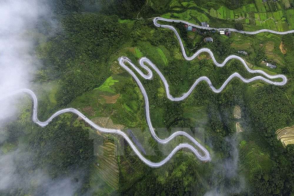
First, there is Ma Pi Leng Pass – one of the most beautiful mountain passes in Vietnam. Located on National Highway 4C, between Pa Vi and Pai Lung villages in Meo Vac district, Ma Pi Leng is famous not only for its majestic landscapes but also for its winding, challenging roads. From the heights of the pass, visitors can admire the panoramic views of deep valleys and layered mountain ranges, a breathtaking scene that astonishes anyone who sees it.
Dong Van Stone Plateau
Next is the Dong Van Stone Plateau, a vast highland that stretches across four districts: Yen Minh, Meo Vac, Dong Van, and Quan Ba. This plateau is not only a global geological heritage site but also a vivid reflection of the diverse cultures of the Lolo, H’Mong, Thai, and other ethnic groups. With its magnificent rocky landscapes and interspersed terraced fields, Dong Van is an unmissable destination for those who love exploration and cultural discovery.
Hoang Su Phi Terraced Fields
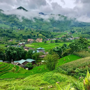
Finally, the Hoang Su Phi Terraced Fields must be mentioned. These terraced fields in Hoang Su Phi are famous not only across Vietnam but also worldwide. In May, during the water pouring season, the terraced fields shine under the sunlight, creating a mystical scene. By the end of September and beginning of October, as the rice ripens to golden, the landscape transforms into a serene and poetic setting, attracting thousands of visitors to admire its beauty.
Each destination on the Ha Giang route has its own unique beauty and irresistible charm. The journey through Ma Pi Leng Pass, Dong Van Stone Plateau, and Hoang Su Phi Terraced Fields is not just a trip but an adventure of discovery, experiencing and appreciating the natural beauty and rich culture of Ha Giang.
Thus, Lily has answered the reader’s question “How long is the Ha Giang loop?”. Lily’s Travel Agency is a provider of Ha Giang tours specifically and tours of Northern Vietnam for international tourists in general. We are proud to be one of the tour providers widely chosen by international visitors. Readers can explore the variety of tours available at Lily’s Travel Agency. We wish you a wonderful trip with many memorable experiences in Vietnam.
See more Northern at tours: Northern Vietnam Tour


