Lung Cung Peak
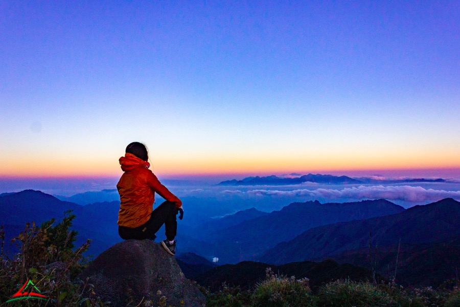
Lung Cung Peak belongs to Lung Cung village, Nam Co commune, Mu Cang Chai district, Yen Bai province. As the highest peak in the Hoang Lien Son range, dividing the boundary between Mu Cang Chai district and Van Ban district of Lao Cai province, with an altitude of 2,913m above sea level, the climate is cool and cloudy all year round. government.
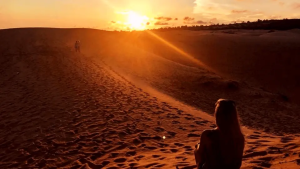
To reach the top of Lung Cung, it takes 45 minutes by motorbike from Lung Cung village along a winding and dangerous road and 11km, you have to walk uphill to the top. But in return for the hard journey is a beautiful scene with primeval vegetation, along with many precious herbs that are cared for and protected by the people here. On the highest peak of Lung Cung, there is a flat land about 1ha wide, with a panoramic view of the surroundings such as Lung Cung valley, Che Cu Nha commune (Mu Cang Chai), communes of Van Ban district (Lao Cai province). )…
The climate here is very fresh with rich vegetation, in the vicinity, there are also forest flowers such as azaleas, red maple trees and some other flowers. But the most attractive thing is that this place still retains its pristine beauty and has never been affected by humans. In recent years, villagers have created tourist routes and guided tourists to climb Lung Cung peak to conquer and explore this peak.
Ba Den Mountain
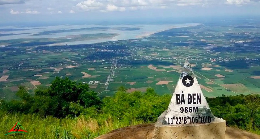
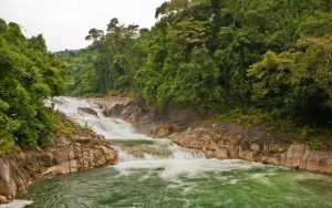
Ba Den Mountain in Tay Ninh province is about 110km from Ho Chi Minh City. Nui Ba complex covers 24km2, including 3 mountains forming: Nui Heo, Nui Phung, Nui Ba Den. Ba Den Mountain is the highest mountain (986m) known as the “roof of the South” and is an adventure tourism destination in Vietnam for backpackers with the beauty of majestic mountain scenery and many caves. The magnificent temples and pagodas associated with many legends are a must-see destination for pilgrims to the southern land.
To conquer Ba Den mountain, you have 3 ways to move: take the cable car, use the slide or climb the mountain. You can try to overcome yourself by climbing the path to concentration while doing gentle exercise and helping yourself to reduce stress after life pressures. If you want to challenge yourself by climbing, there are also many ways to conquer this mountain. According to backpackers, the power pole is the easiest and most popular road to climb.
Besides, there is also a pagoda road, which is the shortest road, but the steepest, rugged and difficult to pass. And the White Rock slope is the most difficult road to conquer, only for those who have good health, a lot of climbing experience and especially must have a guide who is familiar with the terrain.
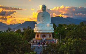
If you go to Ba Den Mountain without watching the sunrise, you will not be able to enjoy this mountain. That’s why backpackers often choose to spend the night here to capture the full moment when the sun is red in the sky, covered with bright pink sunbeams on the bed of Dau Tieng lake.
Read more: Top 10 Vietnam adventure tour for people like challenging (Part 1)
Ma Pi Leng Pass
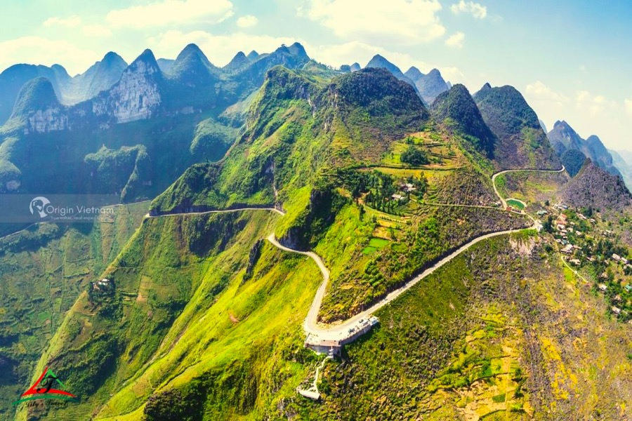
For backpackers, it is no stranger to the name Ma Pi Leng – a pass in the Dong Van rocky plateau, located on Highway 4C, Pa Vi and Pai Lung communes, Meo Vac district, Ha Giang province. It is honored to be located on Ha Giang Happiness Road, connecting Meo Vac town with Ha Giang city.
Ma Pi Leng Route is a legendary pass in Ha Giang province, a perilous 20-kilometer-long pass surrounded by gorgeous mountains. Ma Pi Leng Pass was built with a large number of workers and their bravery. It looks like a very soft winding silk strip and is located on Hanh Phuc road, which connects Dong Van district and Meo Vac town.
The pass is perilously positioned in the midst of the mountain, at the foot of which lies the deep abyss of the Nho Que river; this is a problem for the “photographers,” who must handle the steering wheel firmly so as not to make mistakes. Standing on the cliffs jutting from the Ma Pi Leng pass area, we have a complete view of the great majesty of the northern mountains and woods, watching below the villages and the meandering river, feeling the cold breeze above, white clouds or floating smog feeling “adventure”.
Pha Din Pass – Dien Bien
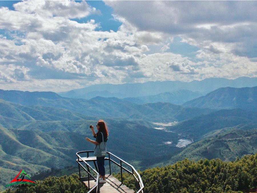
Pha Din Pass is a natural boundary between Dien Bien and Son La provinces, with an altitude of 1000m above sea level, Pha Din is like a rope suspended between the clouds and sky, creating a picture of unspoiled nature. spectacular, attracting tourists from all over the country to explore and experience. In addition to the majestic beauty, Pha Din pass also has a quite rugged terrain with precarious roads and steep slopes. The slope is sometimes 12%, sometimes 15%, even 19%. Therefore, Pha Din pass is only for those who love adventure and conquer. Especially young people who have experience traveling to the Northwest.
Pha Din Pass is located on National Highway 6, with a length of 32 km, connecting the two provinces of Son La and Dien Bien. The pass’s landscape is extremely perilous and precarious, with one side being a cliff and the other a deep abyss; this is a perfect location for travelers looking to take on new and tough challenges. The pass is quite dangerous with 8 bends, many bends on the red dirt road, so it is very slippery in the rainy season. However, from the top of the peak, we can see the entire panorama, with dispersed towns at the foot of the pass, amidst the huge green of the mountains combined with the blue of the big and free sky.
Furthermore, on the summit of Pha Din pass, there is a stele commemorating the nation’s heroic calendar mark during the Dien Bien Phu campaign (1954) of our army and people. You will be able to relive the heroic stories that the people told throughout their forefathers’ fights. Since then, I’ve been in love with this poor yet valiant land.
Hai Van Pass
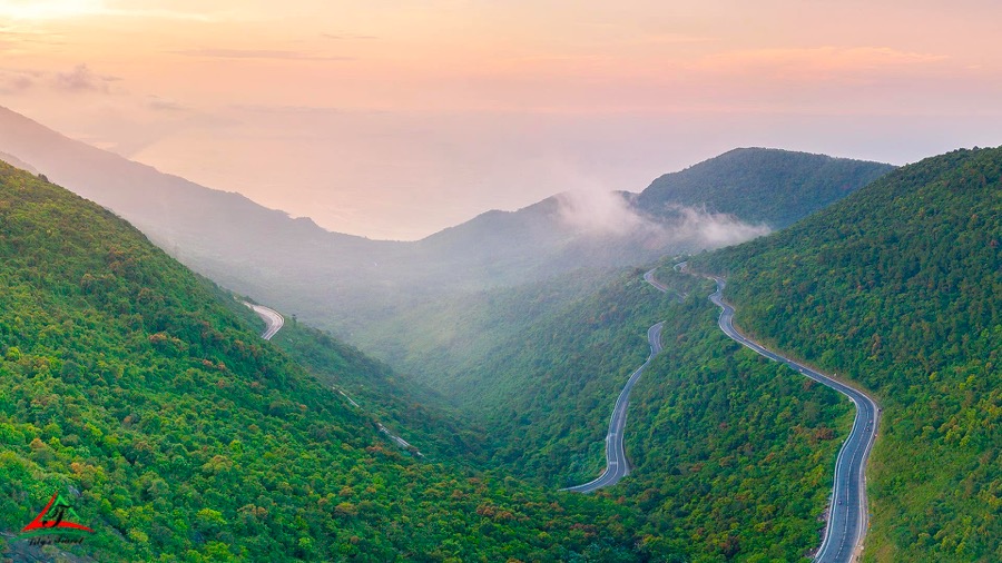
Hai Van Pass, the clouds fly to the top of the mountain, poetic and charming, worthy of being “the most majestic landscape in the world”. The pass is also known as May Pass because clouds cover the top of the mountain all year. This route is exceedingly small and perilous, and it is part of the Truong Son range, which was present in the nation’s historical and heroic fight. Remembering the days when our army and people had to cross this woodland path and pass to supply food and weapons for the struggle to unify the country, this road became terrorized by many wild animals., plunder…
The road is shaky and crooked, and elegant zigzag lines stand out among the glorious green mountains, creating a magnificent picture of nature provided by the Creator. Hai Van Pass is an excellent destination for anyone interested in discovering the beauty of winding roads. If you get the opportunity to visit here, you will undoubtedly want to return since you cannot delay your emotions in front of the unending panorama.
Read more: 15 beautiful places in Vietnam to visit: 15 landscapes to make Vietnam famous in the world
The best center Vietnam tour: Tour in Vietnam