


If you’re staring at a Vietnam Mekong Delta map and trying to figure out where the region actually is, you’re not alone. The Delta doesn’t have one single “center” it’s a sprawling web of rivers, islands, and small cities spread across the entire southern tip of the country. That makes it one of the most rewarding regions to explore, but also one of the easiest to plan badly if you don’t understand the geography first.
This guide walks through exactly what you’ll see on a map of Mekong Delta provinces and waterways, which cities and rivers matter most for travelersn and how to turn that information into a route that actually fits your schedule.
Understanding the Mekong Delta on a map of Vietnam
On a map of Vietnam, the Mekong Delta occupies the entire southwestern end of the country, starting roughly 60-70 km southwest of Ho Chi Minh City and stretching all the way to the Gulf of Thailand and the Cambodian border. It’s flat, low lying, and shaped almost entirely by water; there are no mountains here, only rivers, canals, rice paddies, and a coastline that curves from the East Sea around to the Gulf of Thailand.
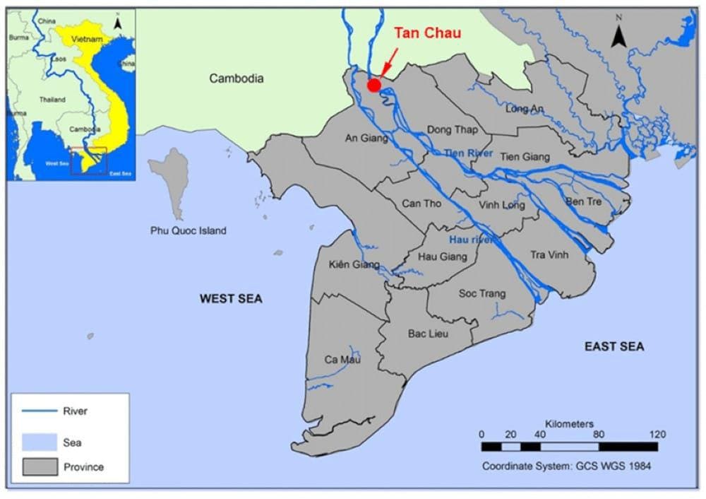
A few orientation points that help the map make sense:
- Ho Chi Minh City sits just north of the Delta and is the entry point for almost every traveler.
- The Mekong River enters Vietnam from Cambodia in the northwest of the region and fans out toward the sea.
- Can Tho, roughly in the geographic middle of the Delta, functions as its unofficial capital and the main transport hub.
- Ca Mau, the southernmost province, marks the literal end of mainland Vietnam.
- Chau Doc and Ha Tien, in the far west, sit right on the Cambodian border and are common crossing points.
Once you can picture this rough triangle Ho Chi Minh City at the top, Ca Mau at the bottom tip, Ha Tien/Chau Doc on the western edge, the rest of the Mekong Delta on a map starts to click into place and everything else in this guide builds on that mental picture.
The main provinces, cities and rivers that make up the Mekong Delta
Since the 2025 merger, the Mekong Delta is now made up of just 6 administrative units (down from 13): the provinces of An Giang, Dong Thap, Vinh Long, Ca Mau, plus the centrally-governed city of Can Tho (former Long An has moved into Tay Ninh province in the Southeast). The old names — Ben Tre, Tien Giang, Kien Giang, Soc Trang — are still used for towns and destinations, but they’re no longer separate provinces. You don’t need to memorize all of them, but recognizing the names that show up most often will save you a lot of confusion when you’re reading a map of Mekong Delta destinations.
Provinces and cities travelers encounter most:
- Long An and Tien Giang: The closest provinces to Ho Chi Minh City, home to My Tho and the popular Ben Tre coconut-country day trips.
- Ben Tre: Known for coconut candy villages, rowboat canals and orchards; a favorite for half day and fullday tours.
- Vinh Long: A common overnight stop with homestays on the river islands.
- Can Tho: The largest city in the Delta and the base for visiting the Cai Rang floating market.
- An Giang: Home to Chau Doc, Sam Mountain, and access to the Cambodian border.
- Dong Tháp: Known for Sa Dec ancient town and the Tram Chim wetlands.
- An Giang (which absorbed the former Kien Giang): gateway to Chau Doc, Ha Tien and Rach Gia — and the ferry port for Phu Quoc.
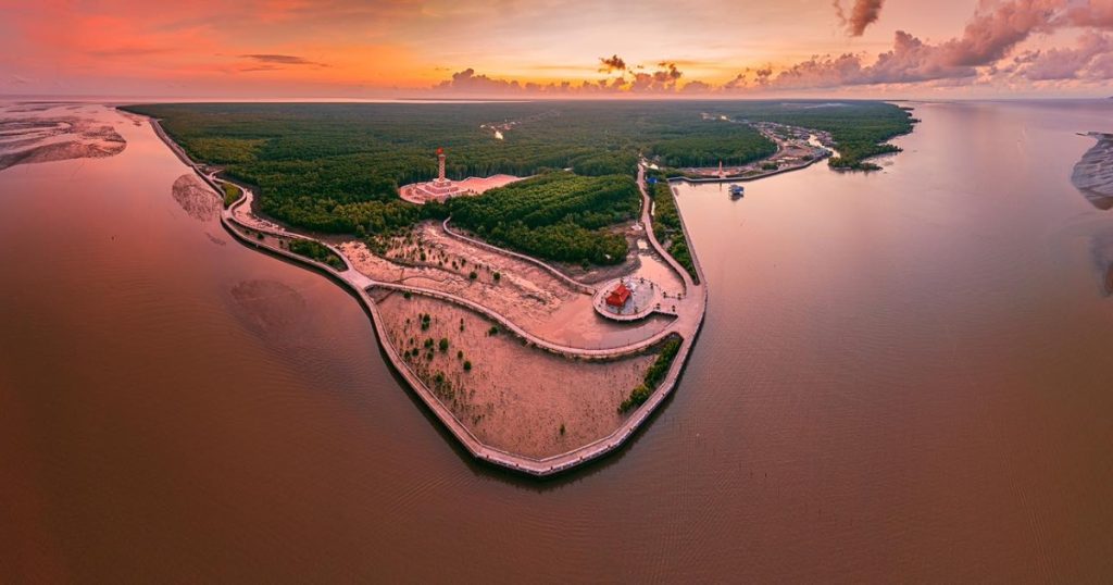
- Soc Trang, Tra Vinh, Bac Lieu, Hau Giang, Ca Mau: Less visited provinces known for Khmer-influenced temples, bird sanctuaries and the Ca Mau Cape mangrove forests at the very southern tip of Vietnam.
The map changed in 2025: trips that once crossed three provinces are now inside one. Vinh Long-Ben Tre-Tra Vinh are a single province today, and Can Tho now reaches the coast via former Soc Trang – so some classic “inter-provincial” loops are now a single-province itinerary. Rivers worth knowing:
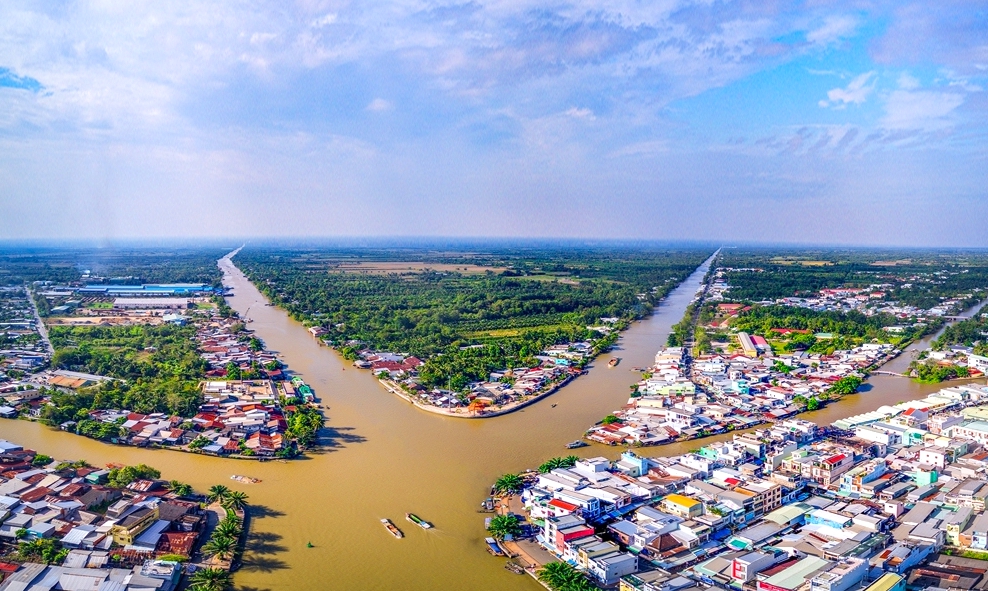
The Mekong River splits inside Vietnam into two main branches, historically called the Tien Giang (Upper River) and the Hau Giang (Lower/Bassac River). These two branches then split further into a total of nine distributaries as they reached the sea. Which is why the Vietnamese name for the region, Cửu Long (Nine Dragons), refers to nine river mouths.
Read more: Phu Quoc To Mekong Delta: The Ultimate Travel Guide
For a traveler, the practical takeaway is simpler: Most Delta towns sit directly on one of these two main branches, so which branch a town belongs to often determines the route and the distance from Ho Chi Minh City.
Understanding the Mekong Delta river map and waterway network
What makes the Delta unique isn’t just its two main rivers, it’s the dense mesh of secondary channels, canals and narrow waterways branching off them. On a detailed Mekong Delta river map, you’ll notice:
- Main branches (Tien Giang and Hau Giang) are wide, used by cargo boats and passenger ferries, and lined with the larger towns.
- Secondary canals, often man made or widened natural channels, connect smaller villages and orchards; these are what the small sampan and rowboat tours take you through.
- Floating markets cluster where waterways intersect, since boats historically gathered at junctions to trade. Cai Rang (near Can Tho) and Cai Be (near Vinh Long/Tien Giang) are the two most visited.
- Islands in the river, such as Unicorn Island (Tan Long) and Phoenix Island near My Tho, or the islands around Vinh Long, are common stops precisely because they sit in the middle of these waterways and are only reachable by boat.
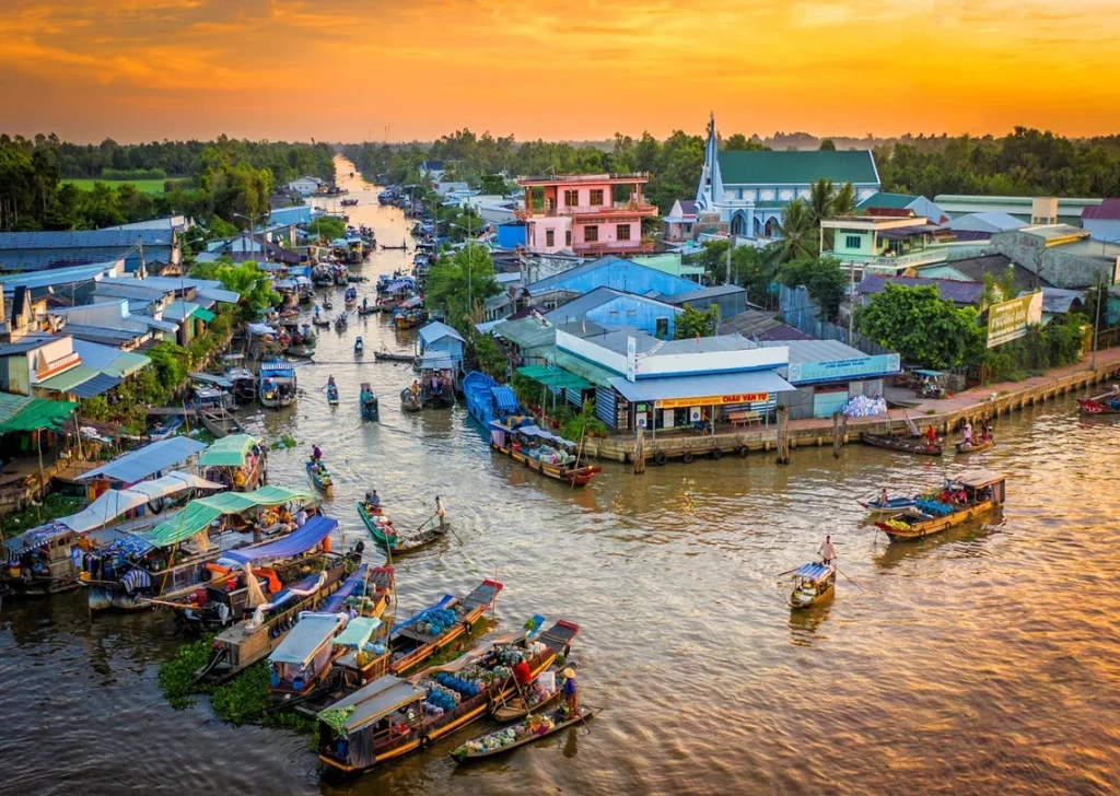
Knowing this helps explain why so many Delta tours involve switching between a car/bus for the main roads and a boat for the final stretch; the waterway network, not the road network, is what actually connects many attractions.
How to use a Mekong Delta map to plan your itinerary
A practical way to use a Vietnam Mekong Delta map when planning:
- Pick your entry point. Almost everyone starts from Ho Chi Minh City, so treat it as kilometer zero.
- Decide how far you’re willing to travel oneway. Under 100 km (My Tho, Ben Tre) suits a day trip. 130-170 km (Vinh Long, Can Tho) suits one or two overnights. Beyond 250 km (Chau Doc, Ha Tien, Ca Mau) needs a dedicated multi day loop.
- Group destinations by river branch, not just by straight line distance, towns on the same branch are usually connected by better roads and more frequent boat links.
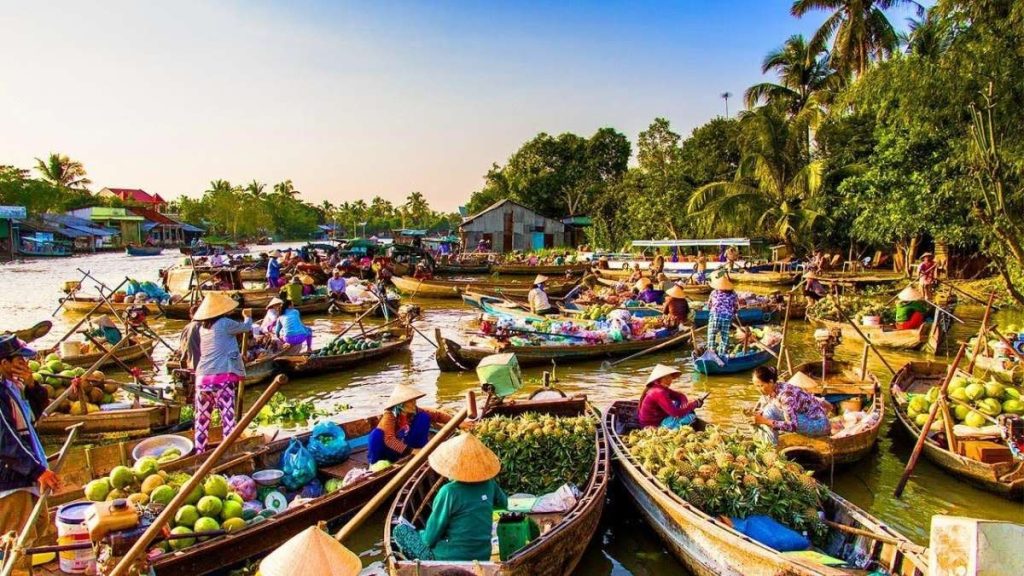
- Build a floating market visit early in the morning, since most markets are busiest and most photogenic between 5:00 and 7:00 AM, which affects where you should sleep the night before.
- Treat Can Tho as a hub, if your trip goes beyond the closest provinces, it has the best transport connections onward to Chau Doc, Ca Mau, or back to Ho Chi Minh City.
Popular routes from Ho Chi Minh city to different parts of the Mekong Delta
Once you’ve studied a map of Mekong Delta destinations, three route patterns cover most travelers’ needs:
- Route A – My Tho & Ben Tre (day trip): Ho Chi Minh City → My Tho → boat to Unicorn/Phoenix Island → Ben Tre coconut village → back to Ho Chi Minh City. Roughly 6-8 hours round trip.
- Route B – Can Tho loop (2-3 days): Ho Chi Minh City → Vinh Long (overnight, homestay) → Can Tho (Cai Rang floating market at dawn) → Can Tho city (1 night) → back to Ho Chi Minh City, or continue onward to Chau Doc.
- Route C – Deep Delta / border route (4+ days): Ho Chi Minh City → Can Tho → Chau Doc (Sam Mountain, Cambodian border views) → Ha Tien (coastal town, ferry connections to Phu Quoc) → return via Rach Gia or fly out from Phu Quoc.
Most tour operators sell simplified versions of Routes A and B, since they match the one- and two day trips most visitors have time for.
Which areas are best for day trips and which are worth staying overnight?
Not every destination you spot on a Vietnam Mekong Delta map deserves the same amount of time.
Best for day trips
If you are constrained by time, stick to provinces that are well-connected to Ho Chi Minh City. These areas are optimized for quick visits, allowing you to see the highlights without the fatigue of long distance travel.
- My Tho: Located at the gateway of the Delta, it is highly accessible and offers a perfect introduction to the region’s river culture.
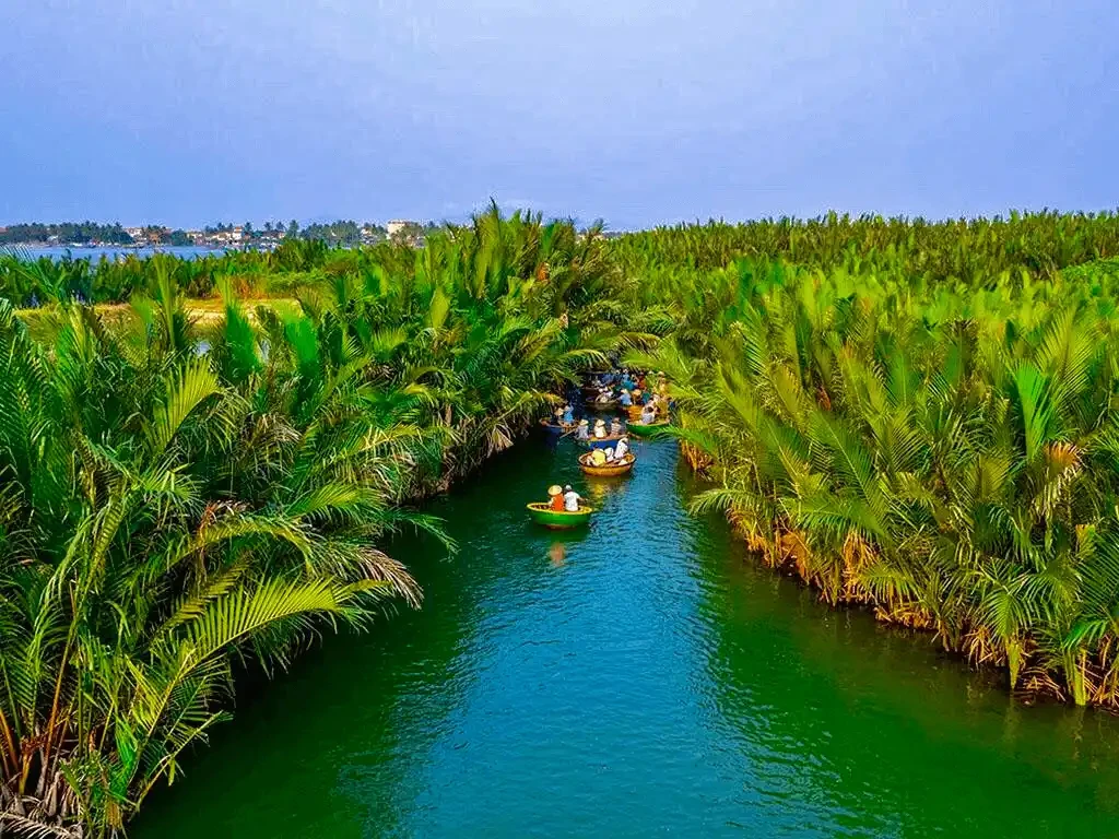
- Ben Tre: Famous for its “coconut kingdom” aesthetic, this province is ideal for a half day or fullday immersion into canal rowing and local craft workshops.
- Cai Be: By studying your map of Mekong Delta locations, you will see that Cai Be is easily reachable via the major roads, making it a convenient spot to catch a glimpse of floating market activity and colonial-era architecture in a single day.
Worth staying overnight
Some destinations offer a depth of culture and natural beauty that simply cannot be absorbed in a few hours. Moving further into the Delta rewards you with quieter, more authentic experiences that require an overnight stay to fully appreciate.
- Vinh Long: The primary draw here is the river island homestay experience. To truly enjoy the peace of cycling through orchards and sleeping in a traditional house on the water, an overnight stay is essential.
- Can Tho: As the unofficial capital, Can Tho is the most critical hub on any Vietnam Mekong Delta map. Because the iconic Cai Rang floating market peaks at dawn (between 5:00 and 7:00 AM), staying in the city the night before is the only logical way to witness the event at its best.
- Chau Doc: Situated deep in the Delta near the Cambodian border, the travel time makes a day trip exhausting. Staying overnight allows you to experience the sunset and sunrise at Sam Mountain and explore the unique floating villages without rushing.
- Ha Tien & Ca Mau: These are the furthest points on your map of Mekong Delta exploration. Due to the significant distance from Ho Chi Minh City, you should plan for at least 1-2 nights to manage the travel time and actually have time to explore the mangrove forests or coastal culture.
Need help mapping out the perfect timeline? Lily’s Travel specializes in creating balanced itineraries that match your schedule to the right geography. Click here to view our recommended tour packages and find the perfect pace for your Delta adventure!
Common misconceptions travelers have when looking at a Mekong Delta map
When looking at a Vietnam Mekong Delta map, it’s easy to assume that distances translate to time the same way they do on a highway map. Unfortunately, the Delta’s geography often defies these expectations, leading to a few common travel mistakes.
- Distance vs. accessibility: A destination might look “close” as the crow flies on a map of Mekong Delta, but in the Delta, you are often limited by the road and bridge network. A 50 km drive can take much longer than anticipated because roads are often narrow, winding. Don’t assume you can “pop over” to a neighboring province quickly.
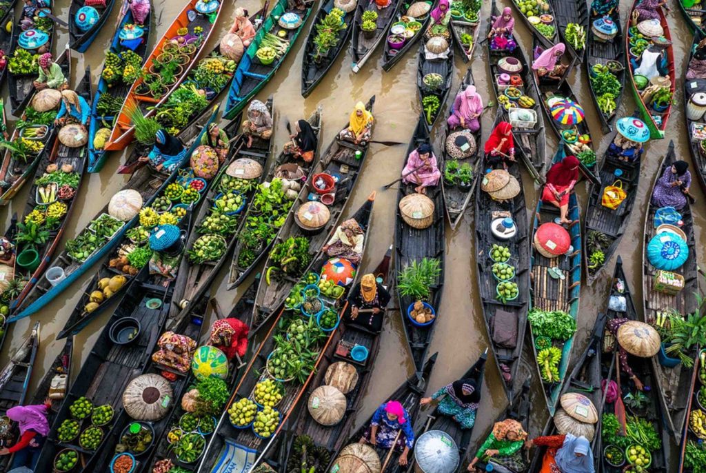
- The “one giant market” myth: Many travelers look at a Mekong Delta Vietnam map and assume floating markets are everywhere and active all day. In reality, markets are specific, localized hubs that operate only in the very early morning. If you are staying on the other side of the region, you won’t be able to “swing by” a market on your way to another activity without planning your entire schedule around that single hour of peak trade.
- Assuming all rivers are the same: A detailed Mekong Delta river map shows a confusing web of lines, but these vary drastically in scale and navigability. You cannot simply take a small tourist sampan from a town like My Tho all the way to Can Tho. You will likely be switching between different types of vessels and road transport throughout your journey. Always clarify with your guide or hotel about how you are actually moving between two points on the map rather than relying on a straight line.
Planning a trip and still feeling overwhelmed by the geography? At Lily’s Travel, we take the guesswork out of your route. Whether you want a quick day trip to the coconut groves or a multi day deep dive into the far west borderlands, our experts handle all the complex logistics of the Delta’s waterways and roads for you.
Suggested 1 day, 2 day and 3 day routes based on location
If you are trying to figure out which part of the Mekong Delta Vietnam map fits your timeline, use these specific, action-oriented itineraries as your baseline. These routes are designed to match the natural geography of the region to minimize transit time and maximize your experience.
1 day route: The coconut & canal experience (Tien Giang & Ben Tre)
- Focus: Perfect for travelers who want a quick but authentic taste of river life.
- Where to go: Travel from Ho Chi Minh City to My Tho and cross the river to Ben Tre.
- What to do: Board a traditional wooden boat to explore the small canals of Thoi Son Island. Visit a local coconut candy workshop, listen to Đờn ca tài tử (traditional folk music) and take a short rowboat ride through the shaded palm fringed creeks.
- Where to stay: Return to Ho Chi Minh City in the evening; no overnight stay is needed for this route on the map of Mekong Delta.

2 day route: The authentic market loop (Can Tho & Vinh Long)
- Focus: The quintessential “Rice Bowl” experience, focusing on local commerce and island tranquility.
- Day 1: Drive from Ho Chi Minh City to Vinh Long. Spend the afternoon cycling along the quiet paths of An Binh Island, visiting brick kilns and fruit orchards.
- Day 2: Wake up early (around 5:00 AM) to take a boat from Can Tho to the Cai Rang floating market. After observing the wholesale trade, visit a noodle making village and head back to the city.
- Where to stay: Spend the first night in a riverside homestay on An Binh Island (Vinh Long). This puts you within an easy morning reach of Can Tho, making it the most logical stop on your Vietnam Mekong Delta map.
3 day route: The deep delta & borderlands (Chau Doc & Kien Giang)
- Focus: For travelers wanting to explore the diverse cultural blend of the far west near the Cambodian border.
- Day 1: Drive from Ho Chi Minh City to Can Tho. Spend the afternoon visiting the Binh Thuy Ancient House and a local cocoa farm.
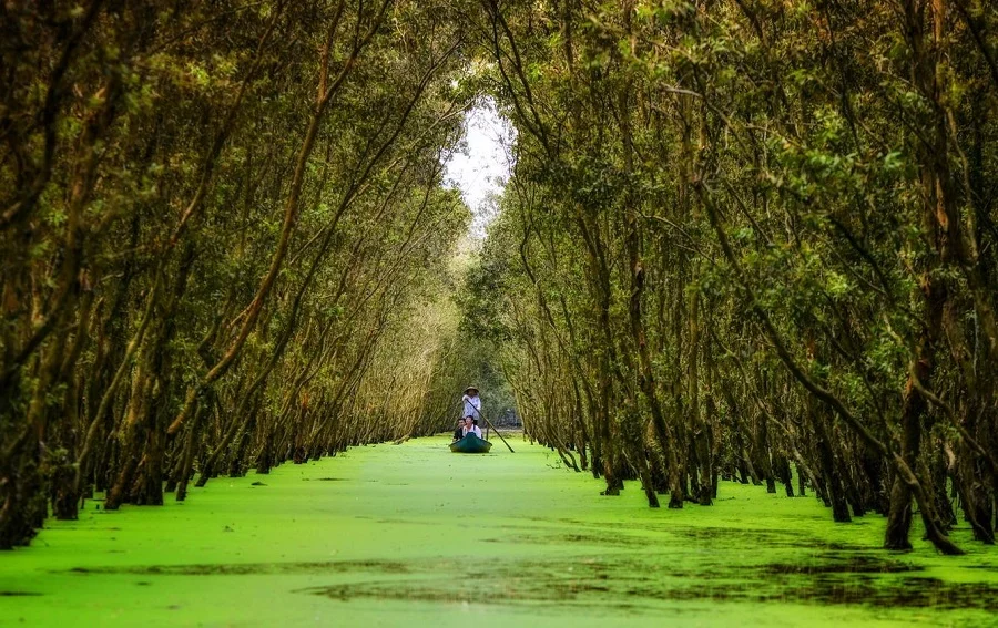
- Day 2: Travel to Chau Doc. Explore the Tra Su Cajuput Forest by small sampan to see the bird sanctuaries. In the late afternoon, head up Sam Mountain for panoramic sunset views over the rice fields and the border.
- Day 3: Visit the floating fish farms and the local Muslim Cham village in Chau Doc before heading to Ha Tien or returning via Rach Gia.
- Where to stay: Night 1 in Can Tho to catch the morning markets; Night 2 in Chau Doc to enjoy the mountain views and border atmosphere.
Frequently asked questions about maps of the Mekong Delta
Navigating the region can feel overwhelming, but understanding the local geography is the key to a smooth journey. Here are the most common questions travelers ask when consulting a Vietnam Mekong Delta map.
Is it easy to rent a car and drive through the Mekong Delta myself?
While it is technically possible, it is not recommended for first-time visitors. The roads depicted on a map of Mekong Delta locations can be incredibly narrow, winding, and shared with heavy local traffic, motorbikes, and carts. Hiring a car with a professional local driver is safer and allows you to enjoy the scenery rather than stressing over complex navigation.
Do I need a physical paper map of the Mekong Delta?
While a paper map is excellent for getting a “big picture” of the provinces, it won’t help you navigate the intricate maze of tiny canal intersections. Google Maps is great for major roads, but when you are on the water, the best “map” is a local boat captain who knows the shortcuts between the orchards and floating markets.
Why does my GPS seem unreliable in the Delta?
When you are deep in the canal systems or moving between small islands, cellular data can become spotty. Additionally, a standard Mekong Delta Vietnam map often shows the main land routes, but it may fail to account for the ferry crossings or seasonal path closures common in the river centric landscape. Always keep your phone charged and carry a portable power bank.
Which provinces have the best infrastructure for tourists?
Tien Giang, Ben Tre, and Can Tho have the most developed infrastructure for international visitors. If you are a first timer planning your first Vietnam Mekong Delta map itinerary, stick to these areas to ensure you have consistent access to reliable hotels, English-speaking guides, and clear boat departure schedules.
The Mekong Delta is far more than just a destination on a map; it is a complex, living landscape where water defines every aspect of life. Whether you are aiming for a quick day trip to the vibrant orchards of Ben Tre or a multi day expedition deep into the borderlands of An Giang, understanding the geography is the secret to moving beyond the tourist trail and finding the true heart of this incredible region. Don’t let the maze of canals intimidate you, once you know how to navigate its flow, the Delta opens up to offer some of the most authentic, peaceful, and visually stunning experiences in all of Vietnam.